


You may also like
-
Planiglobes of the Earth I Poster
Institute of Liepzig · 1860 · Detailed hemispheric world map vintage print with crisp graticules and antique typography
Poster from 69 kr · Framed from 122,67 kr
Regular price From 46,00 krRegular price -
Antique map of Italy Poster
Institute of Liepzig · 1887 · Classic Italy map poster with crisp borders, islands, and dense geographic labeling
Poster from 69 kr · Framed from 122,67 kr
Regular price From 46,00 krRegular price -
Antique map of Africa Poster
Institute of Liepzig · 1851 · Detailed Africa vintage print with gridded coordinates and dense place names
Poster from 69 kr · Framed from 122,67 kr
Regular price From 46,00 krRegular price -
Planet System Poster
Institute of Liepzig · 1988 · Vintage solar system chart poster with green and beige tones and detailed orbits
Poster from 69 kr · Framed from 122,67 kr
Regular price From 46,00 krRegular price


-

"Very nice Posters. The quality is amazing and we received it very quickly !"
-

"A shop to visit absolutely. Huge selection of posters. We spent more than an hour there !"
-

"Perfect to find gift. Price are very good. An they can frame and pack it on site"


About the Artist
The Institute of Liepzig was a prominent force in late 19th-century educational publishing, specializing in the creation of maps and atlases for schools, libraries, and academic institutions. Rather than being the work of a single cartographer, these maps represent the combined expertise of geographers, engravers, and typographers, reflecting a collaborative approach to scientific knowledge and visual communication. Their output contributed to a wider understanding of geography during a period of rapid global change and technological advancement.
This tradition of scholarly mapmaking continues to appeal to collectors and enthusiasts of historical cartography. For those drawn to this legacy, our curated vintage map prints offer further exploration of this fascinating field.
The Artwork
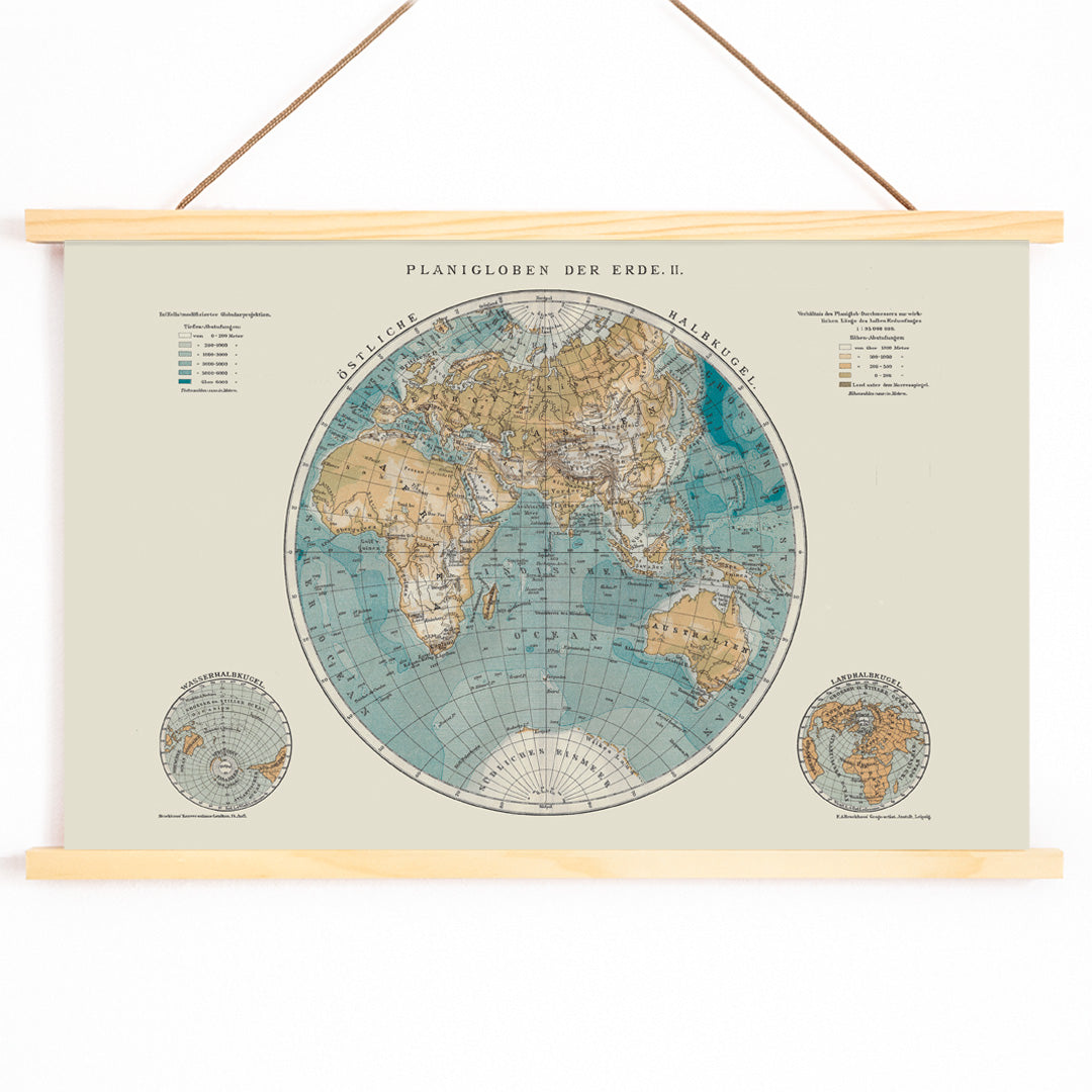
Planiglobes of the Earth II, published in 1894, exemplifies the educational priorities of its era by presenting the world in a double-hemisphere projection. At a time when steamships and telegraph lines were shrinking distances, such maps provided viewers with a new way to conceptualize global relationships, travel routes, and political boundaries. This print served as both a teaching tool and a reflection of how people understood the world before the dramatic geopolitical changes of the 20th century.
Its historical context makes it not only a document of scientific progress but also a testament to the era's curiosity and drive for discovery.
Style & Characteristics
The map features two precisely rendered circular hemispheres, each overlaid with a clear latitude and longitude grid. Surrounding labels and fine linework demonstrate meticulous attention to detail, while the typography is crisp and legible. The color palette is understated, with muted blue tones marking the oceans and sepia or brown outlines defining the continents, all set against a warm beige background that gives the print an archival, authentic feel.
The overall effect is one of calm order and scholarly refinement, making this piece a classic example of late 19th-century cartographic art. For those interested in similar aesthetics, explore our blue tones and science posters collections.
In Interior Design
This vintage print is well suited for display in a study, library, hallway, or above a writing desk, where its intricate details can be appreciated up close. It pairs elegantly with antique wood furnishings, brass accents, and natural textiles, yet its balanced geometry also complements contemporary interiors.
To enhance its archival character, consider framing it in walnut or dark brown, and coordinate with linen or beige decor. For a cohesive gallery wall, combine it with other educational or scientific imagery and select from our range of frames for a tailored finish.