


-

"Very nice Posters. The quality is amazing and we received it very quickly !"
-

"A shop to visit absolutely. Huge selection of posters. We spent more than an hour there !"
-

"Perfect to find gift. Price are very good. An they can frame and pack it on site"


About the Artist
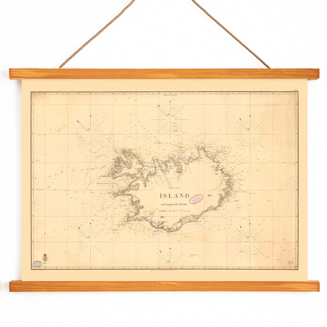
Kongelige Danske Søkort-Arkiv was the Royal Danish sea chart archive, a state maritime institution dedicated to safer navigation through precise hydrographic surveying. In the 1800s, Danish chartmaking combined naval discipline, measured observation, and standardized notation to serve commercial shipping and coastal travel.
This kind of nineteenth-century nautical map poster reflects an era when charts were working tools first, built to be read quickly at sea and trusted under pressure. For collectors today, it also stands as documentary wall art that connects geography with lived history.
The Artwork
Created in 1871, this Map of Iceland belongs to the practical world of North Atlantic seafaring, when accurate coastal knowledge was vital for trade routes, fishing grounds, and safer passages around remote shores. Iceland was closely tied to Denmark during this period, and Danish hydrographic work helped systematize navigation in challenging waters.
As a chart, the map was designed to guide decisions: where depth changes, hazards, and approach lines mattered more than scenery. Now it reads as a vintage print with real historical purpose, and it pairs naturally with other map wall art and sea and ocean posters on a gallery wall.
Style & Characteristics
The image presents Iceland in a clean, survey-driven layout, with the island centered and the surrounding sea treated as an active field for information. Fine linework, tight typography, and chart conventions such as coordinate structure and navigational markings create a measured, authoritative rhythm across the sheet.
A restrained palette of dark ink on warm beige paper gives the piece its vintage clarity, making it easy to read from a distance. The mood is quiet, analytical, and adventurous at once, ideal for anyone seeking a vintage nautical chart print for a study or office.
In Interior Design
This map works as sophisticated wall decor in a living room, hallway, or workspace, especially where travel memories and coastal themes feel at home. It complements Scandinavian interiors, modern minimal spaces, and traditional libraries alike, bringing narrative depth without overpowering the room.
Pair it with pale woods, linen textures, and accents in black, sand, or deep navy for balanced home decor. It also sits beautifully among black and white wall art, and it becomes even more architectural with a well-chosen option from our frames collection.